LAYING THE FOUNDATIONS
Survey Ship
On independence, Pakistan didn’t have any survey organisation or facility. There existed only a Chart Depot at Karachi, which was originally the RIN Depot for Admiralty Charts. Pakistan’s first C-in-C, Rear Admiral (later) Vice Admiral J W Jefford, a surveyor of long standing understood the requirement of a hydrographic service. Considering that, the matter is of national importance, RPN decided to convert one of its River class frigate ZULFIQUAR into a survey vessel in 1949.

Hydrography Training
Hydrographic Office and Cartographic Facility
For the purpose of converting a frigate to a survey vessel and training of survey crew, the services of a surveyor from Royal Australian Navy (Commander later Captain C G Little) were arranged. The conversion was carried out at Karachi in three months with the acquisition of necessary survey equipment from UK. In the absence of any proper training facility, officers and men were imparted improvised training onboard newly converted survey ship. By spring of 1949, Commander Little was able to have a reasonably trained crew and a survey ship at his disposal.
Till 1955, there was no hydrographic facility ashore to support the survey ship and processing of hydrographic data obtained during field surveys by PNS ZULFIQUAR. During monsoons, the surveyors used to proceed to non humid climate of Muree for putting survey data together and effecting repairs of survey equipment through HQs Topographic Section of Pakistan for Mapping, a semi-military unit and originally a part of Survey of India. In 1955, a Hydrographic Office was established at Karachi and a Director of Hydrography was appointed to head the organisation. Commander C.G.Little became the first Director of Hydrography followed by Commanders J. C. Grattan and P.D.J. Hayter. In 1979, the post was re-designated as Hydrographer Pakistan Navy (HPN). The first officer to be appointed to this post was Commander S Mazhar Hussain.
FIRST MODERNIZATION AND EXPANSION PHASE (1976-2000)
Designation of Coordinator NAVAREA IX
For supporting safety of international shipping, Pakistan assumed the responsibility of coordinating broadcast of navigational warnings in capacity of Coordinator NAVAREA-IX. This area is comprised of 16 coastal states of Gulf, North Arabian Sea and Red sea. On behalf of Pakistan, National Hydrographic Office (NHO) is shouldering this responsibility since 1976. In this regards, NHO maintains close liaison with national coordinators and other relevant agencies of NAVAREA IX for acting as per relevant IMO resolutions and IHO guidelines.
Induction of Modern Survey Vessel
Since independence, PN Hydrography Department (PNHD) had been relying on conventional and manual surveying techniques which were laborious and time consuming besides having limited maritime applications. Therefore, requirement of modern survey ship equipped with both hydrographic and oceanographic equipment was strongly felt during late seventies to enhance hydrographic survey progress besides gaining capability of generating data sets to support various marine scientific fields. After extensive efforts, Japanese Govt. agreed to finance survey ship in May 1980. Resultantly, Survey Vessel BEHR PAIMA was delivered to Pakistan on 20 Dec 82. For undertaking survey activities by this ship, survey personnel were deputed to Ministry of Communication as no other organization in Pakistan had hydrographic survey expertise. SV BEHR PAIMA fitted with state of the art oceanographic and hydrographic equipment enabled the surveyors to work with greater accuracy at much higher speed. Moreover, this ship provided opportunity for scientists of National Institute of Oceanography (NIO), academia and other marine stakeholders for regular scientific cruises.

Establishment of Hydrographic School
PN Hydrographic School (PNSH) was established in 1984 at PNS BAHADUR. PNSH was merged with Navigation and Operations (N & O) School in 2011 and later it was named as Navigation and Hydrography (N & H) School. After upgradation of PNHD as National Hydrographic Office (NHO), the school has been made independent and now it is working under NHO as National School of Hydrography (NSH). NSH is jointly accredited by International Hydrographic Organization (IHO), International Cartographic Association (ICA) and International Federation of Surveyors (FIG) to conduct Category "B" Hydrographic Survey Courses and award Internationally recognized/ accepted certificates. Officers from PN and friendly countries have been awarded internationally accredited certificates.

Upgradation of Cartographic Setup
Hydrography data is converted into nautical charts by the process of cartography. In order to modernize the cartographic setup of NHO, a Computer Assisted Cartographic System (CACS) was installed in 1986. The system was upgraded in 1995 with workstations, cartographic software, digitizing tables and drafting machine. This enhanced the capability to process and produce accurate nautical charts. A number of PAK and International Series charts have been produced using this system.
Second Modernization And Expansion Phase (2001-Present)
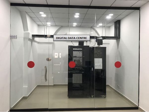
Establishment of National Hydrographic Data Bank
In order to create a national repository of hydrographic data, a National Hydrographic Data Bank (NHDB) was established at NHO in 2001. All old charts, survey fair sheets, survey reports and tide data collected by hydrographic assets and other research cruises was made part of this databank. The collection was created to support provision of held data for various marine applications so that data collected once can be used again and again to economize on cost and effort.
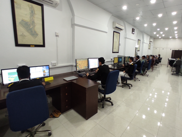
Establishment of ENC Production Setup
Keeping in view the importance of e-navigation and emerging requirements of digital products for supporting safe navigation at sea, Electronic Navigation Chart (ENC) Setup was established in 2005. Till now, the setup has developed ENCs covering all ports of Pakistan including approaches and offshore areas including INT series.
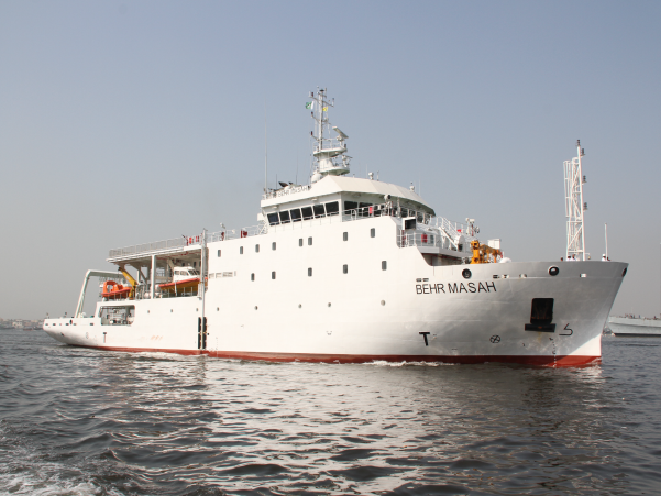
Induction of New Survey Vessel - PNS BEHR MASAH
SV BEHR PAIMA has served Pakistan meritoriously since its induction in 1982. Hence, PN contracted for a new survey ship PNS BEHR MASAH which was inducted on 04 Nov 19. The ship is equipped with state of the art hydrographic, physical oceanographic and geophysical survey equipment. These include both single and multibeam echo sounders, side scan sonars, synthetic aperture sonar, magnetometer, ROV, wave/tide/current gauges, sub bottom profiler, gravity corer etc.
Establishment of Field Survey Setup (FSS)
In 2019, a field survey setup was raised to undertake both land and marine surveys of emergent nature in coastal areas while using easily deployable assets and portable survey systems. This has made coastal area surveys not only efficient but cost effective too.
